 Aero Sync

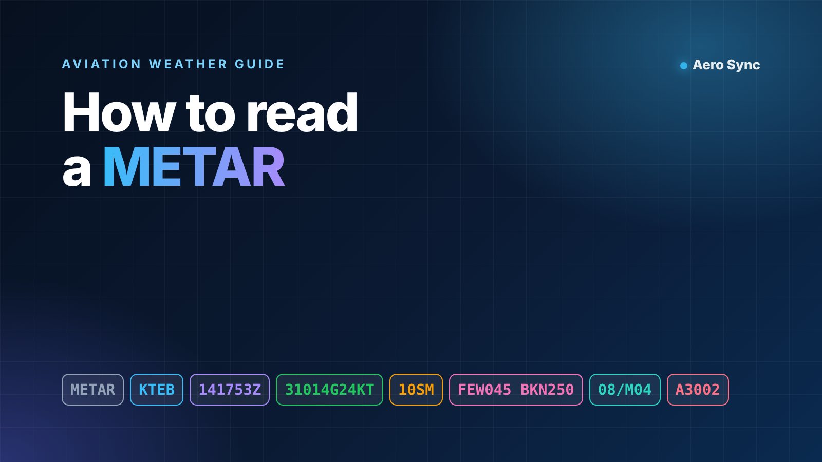
A METAR packs a full airport weather picture into one short line of code. Once you know the order of the groups, it takes less than a minute to decode. This guide shows you how to read a METAR group by group, with real examples, flight categories and the traps that still catch experienced crews.
The example used in this guide: METAR KTEB 141753Z 31014G24KT 10SM FEW045 BKN250 08/M04 A3002. It is a typical afternoon report from Teterboro, the busiest business aviation airport in the New York area.
What is a METAR?
A METAR is a routine surface weather observation for an airport. Most stations issue one every hour. In the United States, routine reports usually go out a few minutes before the top of the hour.
When the weather changes significantly between routine reports, the station issues a special report called a SPECI. It uses exactly the same format. A SPECI often means something important just happened, such as a thunderstorm, a sudden drop in visibility or a new low cloud layer.
The format follows the World Meteorological Organization code, so a METAR from Istanbul, London or New York reads almost the same way. The main differences are units. The US uses statute miles and inches of mercury, while most other countries use metres and hectopascals.
How to read a METAR, group by group
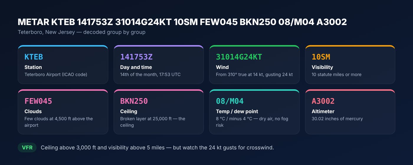
Always read from left to right. Each group answers one question, and the order never changes. Here is the Teterboro example decoded in one picture.
1. Report type and station
The first word tells you whether this is a routine METAR or a SPECI. Next comes the four-letter ICAO code of the airport. KTEB is Teterboro, LTFM is Istanbul Airport and EGLF is Farnborough.
You may also see AUTO after the time. It means the report came from an automated station with no human observer. COR means the report corrects an earlier one.
2. Date and time
141753Z means the 14th day of the month at 17:53. The Z stands for Zulu, which is UTC. METAR times are never in local time, so convert carefully before you brief a client.
3. Wind
31014G24KT means wind from 310 degrees at 14 knots, gusting to 24 knots. The direction is the true direction the wind blows from. Runway headings and ATC winds are magnetic, so expect a small difference.
- VRB means the direction is variable, usually in light winds.
- 00000KT means calm.
- 280V350 after the wind group means the direction is varying between 280 and 350 degrees.
Gusts matter most for business jets. Many operators add half the gust factor to the approach speed. A strong gust across the runway can also push you past the demonstrated crosswind of your aircraft.
4. Visibility and runway visual range
In the US, visibility is given in statute miles, so 10SM means ten miles or more. In most other countries it is given in metres. 9999 means ten kilometres or more, and 0800 means 800 metres.
Some reports add runway visual range, for example R04/1800FT. It tells you how far a pilot can see along that runway, which matters for low-visibility approaches.
You may also see CAVOK outside the US. It means ceiling and visibility OK: at least ten kilometres visibility, no cloud below 5,000 feet, no cumulonimbus and no significant weather.
5. Present weather
This group describes what is happening right now. A minus sign means light and a plus sign means heavy. No sign means moderate.
| Code | Meaning | Why it matters |
|---|---|---|
| RA / -RA / +RA | Rain, light rain, heavy rain | Wet runway, longer landing distance |
| SN / FZRA | Snow / freezing rain | Contamination and airframe icing |
| BR / FG | Mist / fog | Low visibility, possible diversion |
| TS / TSRA | Thunderstorm / thunderstorm with rain | Wind shear, hail, delays |
| SH / VC | Showers / in the vicinity | Conditions can change quickly |
6. Clouds and ceiling
Cloud cover is reported in eighths of the sky, called oktas. The three digits that follow give the base in hundreds of feet above the airport.
- FEW covers 1 to 2 oktas.
- SCT (scattered) covers 3 to 4 oktas.
- BKN (broken) covers 5 to 7 oktas.
- OVC (overcast) covers the whole sky.
The ceiling is the lowest broken or overcast layer. In our example, FEW045 is not a ceiling, but BKN250 is. A vertical visibility group such as VV002 also counts as a ceiling. It means the sky is obscured and you can only see 200 feet up.
Watch for CB or TCU after a cloud group, as in SCT030CB. These mark cumulonimbus and towering cumulus, the clouds that produce thunderstorms.
7. Temperature and dew point
08/M04 means a temperature of 8 °C and a dew point of minus 4 °C. The M stands for minus. When the two numbers are within about 3 °C, the air is close to saturation and fog or low cloud may form, especially after sunset.
Temperature also drives aircraft performance. A hot day at a high airport can cut payload or range, so pilots check this group on every departure.
8. Altimeter setting
A3002 means 30.02 inches of mercury. Outside the US, you will see a Q group such as Q1013, which is 1013 hectopascals. Setting the wrong value is a classic error, so read it back aloud.
9. Trend and remarks
Many reports outside the US end with a short trend. NOSIG means no significant change is expected in the next two hours. TEMPO and BECMG warn of temporary or lasting changes.
US reports often end with RMK, short for remarks. AO2 means an automated station with a precipitation sensor. SLP166 gives the sea-level pressure as 1016.6 hectopascals.
What do VFR, MVFR, IFR and LIFR mean?
Flight categories turn ceiling and visibility into one simple label. The worse of the two values decides the category. Dispatchers and operations teams use them to see the overall picture in seconds.
| Category | Ceiling | Visibility |
|---|---|---|
| VFR | Above 3,000 ft | More than 5 miles |
| MVFR (marginal VFR) | 1,000 to 3,000 ft | 3 to 5 miles |
| IFR | 500 to below 1,000 ft | 1 to below 3 miles |
| LIFR (low IFR) | Below 500 ft | Less than 1 mile |
Our Teterboro example is VFR, with a ceiling at 25,000 feet and ten miles of visibility. Compare it with METAR KTEB 141053Z 00000KT 1/2SM FG VV002 03/03 A3011. Calm wind, half a mile in fog and a 200-foot vertical visibility make that report LIFR.
How is a METAR different from a TAF?
A METAR tells you what the weather is right now. A TAF, or terminal aerodrome forecast, tells you what is expected over the next 24 to 30 hours. It covers an area of about five miles around the airport.
Good flight planning uses both. The METAR shows whether the forecast is working out. If the METAR is already worse than the TAF, treat the rest of the forecast with caution and plan a solid alternate.
Common mistakes: treating METAR winds as magnetic, reading times as local time, calling a FEW or SCT layer a ceiling, ignoring gusts in the crosswind check, and using an old report. Always check the time group before you brief.
Read every METAR left to right, find the ceiling, check the gusts, and compare it with the TAF.
Key takeaways
- A METAR always follows the same order: station, time, wind, visibility, weather, clouds, temperature, pressure.
- All times are UTC and the wind direction is true, not magnetic.
- The ceiling is the lowest BKN or OVC layer, or a VV group.
- A temperature and dew point within 3 °C is a fog warning.
- Compare the METAR with the TAF before every departure.
How to read a METAR faster with Aero Sync
Decoding by hand is a skill every crew member should have. In daily operations, though, speed and accuracy matter more. The Aero Sync Aviation Weather tool pulls live METARs and TAFs from the NOAA Aviation Weather Center and decodes them in plain language.
It also calculates headwind and crosswind for every runway, shows the flight category and exports a clean PDF briefing for your crew or client. It sits next to flight scheduling and client e-mail in the Aero Sync platform.
For the official definitions, see the weather section of the FAA Aeronautical Information Manual. You can check live reports at the Aviation Weather Center.
Frequently asked questions
How often is a METAR issued?
Most airports issue a routine METAR every hour. When conditions change significantly between reports, the station issues a special report called a SPECI.
What does AUTO mean in a METAR?
AUTO means the report was produced by an automated weather station with no human observer. Automated stations may miss some weather, such as distant thunderstorms, so check the remarks.
Is METAR time local or UTC?
METAR times are always in UTC, shown by the letter Z. For example, 141753Z means the 14th day of the month at 17:53 UTC.
What is the difference between a METAR and a TAF?
A METAR reports the current weather at an airport. A TAF forecasts the expected weather for the next 24 to 30 hours. Pilots use both together to plan a flight.